Construction Site Surveying Guide for GCs

Construction Site Surveying Basics: What Every GC Needs to Know
If you have been in this business long enough, you have seen what happens when someone skips the survey or tries to wing it with a property line. Foundations end up two feet into the setback. Retaining walls get built on the neighbor’s lot. Drainage gets graded the wrong direction. And every single one of those problems costs ten times more to fix than the survey would have cost in the first place.
Site surveying is not the most exciting part of construction. Nobody got into this trade because they love reading plat maps. But understanding what surveys do, when you need them, and how to work with your surveyor will save you from the kind of mistakes that eat your margin and wreck your schedule.
This guide breaks down the three types of surveys you will deal with most often as a GC: boundary surveys, topographic surveys, and construction staking. We will cover what each one tells you, when to order them, and how to avoid the most common screw-ups.
Why Surveying Matters More Than Most GCs Think
Here is the thing about surveying: it is the foundation of everything else on the project. Your blueprints are only as good as the survey data they are based on. Your site plan only works if someone actually verified where the property lines are. Your grading plan only makes sense if the existing elevations are accurate.
I have talked to plenty of contractors who treat the survey as a checkbox. Something the engineer or architect ordered, something that showed up in the bid documents, something they glanced at and filed away. That is a mistake.
As a GC, you need to be able to read a survey, understand what it is telling you, and know when the information is missing or outdated. You do not need to be a licensed surveyor, but you need enough knowledge to ask the right questions and catch problems before they turn into change orders.
Think of it this way. You would not start framing without checking the foundation dimensions. So why would you start site work without checking the survey?
The cost of a survey is almost always less than one percent of total project cost. The cost of a survey-related mistake can be five to ten percent or more, plus weeks of delays while lawyers and engineers sort things out.
Boundary Surveys: Know Where Your Property Starts and Stops
A boundary survey establishes the legal limits of a property. The surveyor researches the deed, finds or sets monuments at the property corners, and produces a plat or map showing the property lines, dimensions, and any easements or encroachments.
This is the most fundamental survey you will encounter, and it answers one simple question: where exactly is this property?
What a boundary survey includes
- Property corners and monuments. These are the physical markers (iron pins, concrete monuments, or other markers) that define the corners of the parcel. The surveyor will find existing monuments or set new ones.
- Property line dimensions. The bearing and distance of each property line, tied to a coordinate system or reference point.
- Easements. Utility easements, access easements, drainage easements. Anything that gives someone else the right to use part of the property.
- Encroachments. If the neighbor’s fence, shed, or driveway crosses onto the property (or vice versa), the survey will show it.
- Setback lines. The required distance from property lines where construction is prohibited. These come from zoning and land use regulations, not from the surveyor, but a good surveyor will show them on the plat.
When you need a boundary survey
You need a boundary survey before any project where the building location matters relative to the property line. That is basically every project. Specifically:
- New construction on undeveloped lots. Always. No exceptions.
- Additions or expansions. If you are building closer to a property line than the original structure, you need to verify where that line is.
- Fence or retaining wall projects. These are the projects where boundary disputes happen most often.
- Any project requiring a site plan for permitting. Most jurisdictions require a survey as part of the site plan submission.
Common boundary survey mistakes GCs make
The biggest mistake is assuming the existing survey is still accurate. Surveys can be 10, 20, or 30 years old. Monuments get disturbed by previous construction, utility work, or just time. If you are relying on an old survey, at least have a surveyor verify the corners before you start.
The second biggest mistake is assuming the fence line is the property line. It almost never is. I have seen fences that were off by three, four, even ten feet. Never assume a fence, tree line, or other visible feature represents the legal boundary.
Topographic Surveys: Mapping What Is Actually Out There
While a boundary survey tells you where the property is, a topographic survey (topo survey) tells you what is on it and how the ground is shaped. This is the survey that gives your engineers and architects the existing conditions they need for design.
A topo survey maps elevations, slopes, drainage patterns, existing structures, trees, utilities, and other physical features of the site. It produces a contour map that shows the shape of the terrain.
What a topo survey includes
- Contour lines. Lines of equal elevation, usually at one-foot or two-foot intervals. These show slopes, ridges, valleys, and flat areas. On tight sites or detailed grading plans, you might need half-foot contours.
- Existing structures. Buildings, pavement, walls, fences, anything built on the site.
- Vegetation. Trees (with species and diameter for those over a certain size), tree lines, hedgerows. If there is a tree preservation ordinance, this data is critical.
- Utilities. Visible utility features like manholes, fire hydrants, power poles, utility boxes, and valve covers. Underground utilities are typically located separately.
- Drainage features. Swales, ditches, culverts, storm drains, retention areas. Understanding existing drainage is essential for your land development work.
- Benchmark and control points. Reference points with known elevations that you will use throughout construction.
How GCs use topo survey data
The topo survey feeds directly into your site design. Your civil engineer uses it to design grading plans, stormwater management, and utility routing. Your architect uses it to set finished floor elevations and design the building pad. Your estimator uses it to calculate cut and fill quantities.
If you are putting together a bid, the topo survey is where your earthwork numbers come from. Bad topo data means bad earthwork estimates, and earthwork is one of the biggest cost variables on any site project. When you are building your numbers in your estimating software, the accuracy of your cut-and-fill calculations depends entirely on the accuracy of the topo.
A topo survey also helps you identify potential problems early. Weird drainage patterns, unexpected slopes, buried structures, or utility conflicts. Finding these in the office costs nothing. Finding them in the field costs a lot.
When to order a topo survey
Order the topo survey early in pre-construction planning. Your design team needs this data before they start drawing. If you wait until design is underway, you risk the engineers making assumptions about existing conditions that turn out to be wrong.
For bid-build projects, the topo survey should already be in the bid documents. Review it carefully. Check the date. If it is more than a year old, conditions may have changed, especially on sites with ongoing development nearby.
For design-build projects, ordering the topo survey is often your responsibility. Get it done as soon as you have access to the site.
Construction Staking: Putting the Plan on the Ground
Don’t just take our word for it. See what contractors say about Projul.
Construction staking (also called layout or field layout) is where the survey goes from paper to dirt. A surveyor takes the design drawings and marks the exact locations, elevations, and alignments on the ground so your crews know where to dig, pour, and build.
This is the survey work that happens during construction, and it is the one that most directly affects your day-to-day operations.
Types of construction staking
- Rough grading stakes. Cut and fill stakes that tell your equipment operators how much dirt to move and in which direction. These typically show the amount of cut (marked with a C) or fill (marked with an F) needed at each stake location to reach design grade.
- Building layout. Offset stakes or batter boards that define the building corners, foundation lines, and column locations. These get set just before excavation or forming.
- Utility staking. Marks the planned location and depth of water, sewer, storm, gas, electric, and communication lines. Your soil testing results might affect utility trench depths and bedding requirements, so coordinate with your geotech.
- Curb and gutter. Flow line grades and alignment for curbs, gutters, and pavement edges.
- Final grade stakes. Finish grade elevations for parking lots, sidewalks, and other paved areas. These are the last stakes set before paving.
- As-built survey. After construction, the surveyor returns to document what was actually built and where. Many jurisdictions require as-builts before they will issue a certificate of occupancy.
How to work with your surveyor during construction
Good communication with your surveyor during construction saves time and prevents rework. Here are a few practical tips:
Give them advance notice. Survey crews are busy. Do not call on Monday morning expecting stakes by Monday afternoon. Give at least a week of lead time for staking visits, more during busy season.
Protect the stakes. This sounds obvious, but stakes get knocked out by equipment, buried by grading, and pulled up by curious subcontractors constantly. Brief your crews on which stakes matter and where they are. When stakes get disturbed, call the surveyor back before proceeding.
Provide the right drawings. Your surveyor needs the most current design drawings, and they need them in a usable format. CAD files are ideal. PDFs work in a pinch. Hand-sketched napkin drawings do not.
Be on site or available. When the survey crew is staking, have someone available who can answer questions about the design intent. Surveyors are precise, but they are not mind readers. If there is an ambiguity in the plans, they need to know how you want it resolved.
Document everything. Take photos of stakes and markings before your crews start work. If a dispute comes up later about whether something was staked correctly, photos are your best evidence. Use a tool like Projul’s photos and documents feature to keep survey photos organized and tied to the project.
Reading Survey Documents: What GCs Need to Understand
You do not need to be a surveyor to read a survey. But you do need to know what you are looking at. Here are the key elements you will encounter on survey documents.
Plat maps
A plat map shows the boundaries of a property (or subdivision) with dimensions, bearings, easements, and other legal information. When you see something like “N 45°30’15” E, 150.00’” on a plat, that is a bearing and distance describing a property line. North 45 degrees, 30 minutes, 15 seconds east, for 150 feet.
You do not need to do the math. You need to know that those numbers describe a specific line on the ground, and if your building is supposed to be 25 feet from that line, you had better know where that line is.
Contour maps
Contour lines connect points of equal elevation. Lines that are close together mean steep slope. Lines that are far apart mean gentle slope or flat ground. A hilltop shows as concentric circles getting smaller toward the center. A valley shows as V-shaped contours pointing uphill.
When you are reviewing a grading plan, check the existing contours against the proposed contours. The difference between them is your cut and fill. Major differences mean major earthwork.
Benchmark information
Every survey references a benchmark, a point with a known elevation. All other elevations on the survey are relative to this benchmark. Make sure you know where the benchmark is and that it is still in place before construction starts. If the benchmark gets destroyed, your elevation control for the entire project is gone.
On many projects, the surveyor will set a temporary benchmark (TBM) on a permanent feature near the site, like a fire hydrant or utility manhole. Write down where it is. Take a photo. Share it with your superintendent and your grading sub.
Survey certifications and notes
The certification is the surveyor’s statement about what they did, when they did it, and the standard they followed. Read the notes section carefully. Surveyors use notes to flag things they found but could not resolve, like conflicting deed descriptions, missing monuments, or encroachments. These notes often contain early warnings about problems that will affect your project.
Common Surveying Problems and How to Avoid Them
After years of seeing projects go sideways because of survey issues, here are the problems that come up again and again.
Problem: The survey is outdated
A survey from five years ago might not reflect current conditions. Trees have grown, neighbors have built additions, utilities have been installed, and grading has changed. If you are working with an old survey, get the surveyor to update it or at least field-verify the critical elements.
Problem: Conflicting surveys
Adjacent properties sometimes have surveys that disagree about where the boundary is. This happens more often than you would think, especially in older neighborhoods where original surveys were less precise. If you discover conflicting surveys, stop and get a surveyor involved before you build anything near the disputed area.
Problem: Missing utilities
Topo surveys show visible utility features, but they do not show everything underground. Always call 811 (or your local one-call center) for utility locates before digging. The topo survey supplements utility locates but does not replace them. If you are doing significant underground work, consider hiring a private utility locating company for a more thorough investigation.
Problem: Elevation datum confusion
Different surveys on the same site might reference different elevation datums. If your topo survey uses NAVD88 and your benchmark certificate uses NGVD29, your elevations will be off by a foot or more. Make sure all survey data on your project references the same datum, or know the conversion factor.
Problem: Stakes getting destroyed
This happens on every project. Have a plan for it. Know your surveyor’s availability for re-staking, budget for re-staking visits, and document stake locations with photos and measurements to permanent features so you can verify if a stake has been moved.
Problem: GC does not review the survey before bidding
This might be the most expensive mistake of all. If you bid a project without carefully reviewing the survey, you are gambling. Check for access issues, easement restrictions, slope challenges, utility conflicts, and setback constraints. All of that information is on the survey. All of it affects your price.
Putting It All Together: Survey Workflow for GCs
Here is a practical timeline for how surveying fits into your project workflow.
Pre-bid or pre-construction
- Review existing survey documents. Look at what is in the bid package or what the owner provides. Check dates, completeness, and whether the information matches what you see on the site.
- Visit the site. Walk the property with the survey in hand. Do the features on the survey match what is actually there? Are there visible issues (encroachments, drainage problems, steep slopes) that the survey should address?
- Order additional surveys if needed. If the existing survey is outdated, incomplete, or missing, get a new one. Factor survey costs into your bid or pre-construction budget.
- Coordinate with your design team. Make sure your engineers and architects have the survey data they need in the format they need it (usually CAD files).
During permitting
- Verify setbacks and easements. Cross-check the survey against zoning requirements and permit conditions. Make sure the proposed building location works within all constraints.
- Address any survey issues. If the permit reviewer flags a boundary question or easement concern, get your surveyor involved immediately.
During construction
- Schedule staking visits. Work with your surveyor to schedule staking visits that align with your construction schedule. Build in lead time.
- Protect survey control. Know where your benchmarks and control points are. Protect them from construction activity.
- Document staked locations. Photograph stakes and reference them to permanent features before construction begins at each phase.
- Call for re-stakes when needed. Do not guess. If stakes are disturbed, get the surveyor back out.
Project closeout
- Order as-built survey. Many jurisdictions require an as-built survey or foundation location survey before final inspection. Schedule this early enough that it does not hold up your CO.
The survey is one of those things that is easy to take for granted when it goes right. But when it goes wrong, it can blow up an entire project. Spend the time and money to get it right up front. Your future self will thank you.
Curious how this looks in practice? Schedule a demo and we will show you.
Ready to keep your survey documents, site photos, and project details organized in one place? See how Projul can help with a free demo.
Frequently Asked Questions
How much does a construction site survey cost?
What is the difference between a boundary survey and a topographic survey?
When should a general contractor order a site survey?
Do I need a licensed surveyor for construction staking?
How long does a site survey take to complete?
Related Articles

Construction Septic System Installation: What Every GC Needs to Know
Septic systems on rural builds bring unique scheduling, permitting, and soil challenges that can wreck your timeline if...
Read More →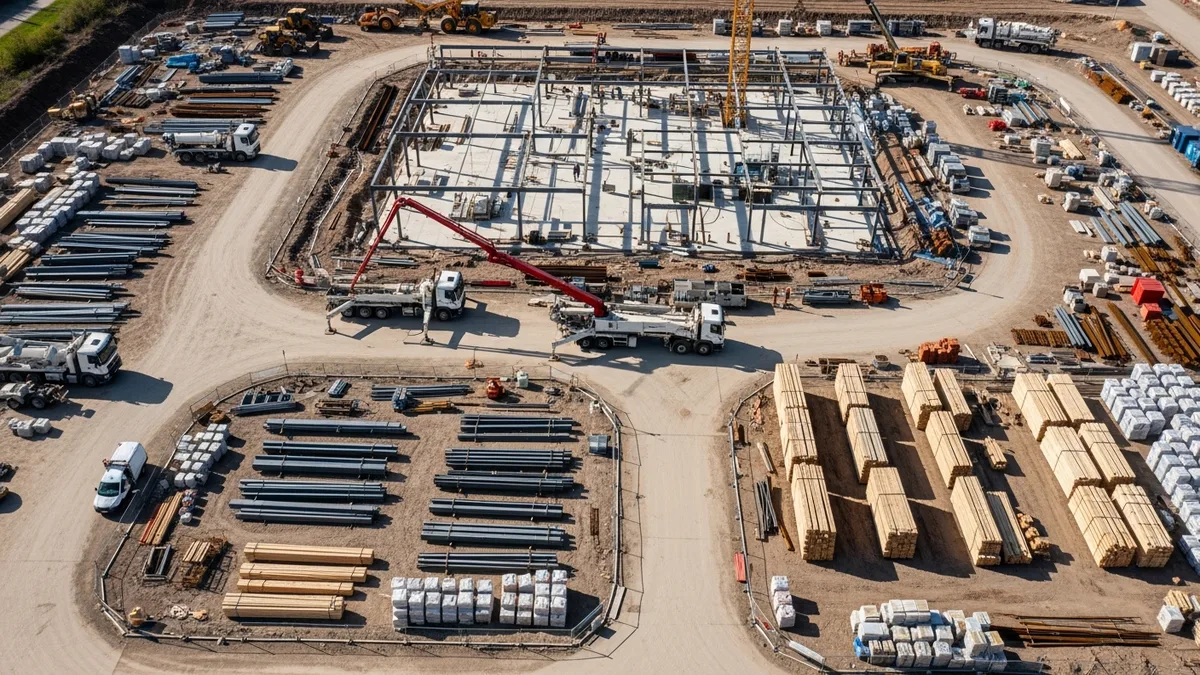
Construction Painting Project Management: Coordinating Interior and Exterior Phases
Painting is one of those trades that touches every other trade on the schedule. Get the sequencing wrong, and you're...
Read More →
Epoxy Flooring and Industrial Coatings: A Contractor's Complete Guide
Epoxy flooring and industrial coatings are high-margin work when you get the process right and a fast way to lose money...
Read More →