Construction Drone Surveying & Aerial Photography Guide | Projul

Drones have gone from expensive military hardware to a tool that fits in your truck’s center console. If you have not started using one on your jobsites yet, you are leaving money on the table and handing a competitive edge to the contractor down the road who has.
This guide walks through the practical ways contractors are putting drones to work right now, from initial site surveys to final client presentations, and covers the FAA rules you need to follow so you do not end up with a fine instead of a flight.
Why Drones Make Sense for Construction Companies
Let us get the obvious out of the way: drones save time and money. But the real value goes deeper than that.
A traditional topographic survey of a 10-acre site might take a two-person crew two full days with total station equipment. A single drone operator can cover the same area in 30 to 45 minutes of flight time, then process the data overnight. The labor savings alone pay for the drone within a few projects.
But speed is only part of the story. Drones give you a perspective you simply cannot get from ground level. When you are standing on a jobsite, you see what is directly in front of you. From 200 feet up, you see the entire project at once: grading issues, staging problems, areas where crews are bottlenecked, and progress that is hard to appreciate from the ground.
Here is what contractors are actually using drones for on a daily basis:
- Pre-construction site surveys that capture existing conditions before a single shovel hits dirt
- Weekly or biweekly progress photos that create a visual timeline of the entire build
- Stockpile volume measurements for earthwork, gravel, sand, and fill materials
- Roof and structure inspections that keep workers off ladders and away from fall hazards
- Marketing photos and videos for your website, social media, and proposals
- Client updates and presentations that show real progress instead of just talking about it
The contractors who are winning bids right now are the ones who show up to presentations with aerial site maps, 3D models, and progress timelines. If you are still relying on ground-level photos and verbal updates, it is worth rethinking your approach. Good photo documentation practices are already a baseline expectation, and drones take that to another level entirely.
Site Surveys and Pre-Construction Mapping
The first place most contractors put drones to work is during the survey and pre-construction phase. Here is how it typically plays out.
Topographic Mapping
You fly a grid pattern over the site at a set altitude, usually between 150 and 250 feet depending on the terrain and the level of detail you need. The drone captures hundreds or thousands of overlapping photos. Photogrammetry software like Pix4D, DroneDeploy, or Propeller stitches those images together into an orthomosaic map, which is essentially a scaled, geo-referenced aerial photo of the entire site.
From that same data set, the software generates:
- Digital elevation models (DEMs) showing terrain height at every point
- Contour maps with whatever interval you specify
- 3D point clouds that can be imported into CAD or BIM software
- Cut and fill calculations comparing existing grade to proposed design
This data feeds directly into your estimating process. When you are putting together a bid that includes earthwork, having accurate existing-conditions data means your numbers are based on reality, not guesswork. If you are looking to tighten up your estimating workflow, drone survey data is one of the best inputs you can add.
Boundary and Condition Documentation
Before you start work, fly the entire site and the surrounding area. Capture the condition of neighboring properties, existing fences, trees, drainage patterns, and anything else that could become a dispute later. This baseline documentation has saved more than a few contractors from bogus damage claims.
Store these images and videos with your other project documents. If you already have a system for construction document management, adding drone files is just one more category.
Existing Structure Inspections
For renovation and addition projects, drones let you inspect roofs, facades, and hard-to-reach areas without scaffolding or boom lifts. A 15-minute flight can replace half a day of setup, inspection, and teardown. The close-up photos and video you capture are detailed enough to identify cracked flashing, damaged shingles, deteriorating mortar, and structural concerns.
Progress Monitoring and Reporting
Once construction starts, drones become your most efficient reporting tool.
Weekly Flyovers
Set a recurring schedule to fly the site at the same altitude, same flight path, every week or every two weeks. This consistency matters because it gives you an apples-to-apples comparison over time.
Most mapping platforms let you overlay images from different dates so you can slide between them and see exactly what changed. Project owners and lenders love this because it removes any ambiguity about whether work is actually getting done.
Daily Report Integration
Pair your drone photos with your daily reports and you have a documentation package that is hard to argue with. A written report says “poured footings in section B today.” A drone photo from 200 feet up shows exactly which footings, where they are relative to the rest of the site, and what the surrounding conditions looked like.
This combination is especially valuable for dispute resolution. If a subcontractor claims they completed work by a certain date, your time-stamped aerial photos either confirm or contradict that claim with zero ambiguity.
Schedule Tracking
When you compare drone progress photos against your construction schedule, you get an honest picture of whether the project is on track. This is harder to fudge than a verbal status update in a meeting.
If you are using construction scheduling software, you can link aerial progress photos to specific milestones and tasks. Some contractors create a side-by-side view: the schedule says we should be here, and the drone photo shows where we actually are.
Volumetric Measurements and Earthwork Tracking
This is where drones start paying for themselves in a very direct way.
How Volumetric Measurement Works
The drone flies a grid pattern over a stockpile or excavation area. The photogrammetry software builds a 3D model of the surface. You define the base plane, which is the ground level around the stockpile or the design grade for an excavation, and the software calculates the volume above or below that plane.
The math is straightforward: the software breaks the surface into millions of tiny triangles, calculates the volume of each triangular prism between the surface and the base plane, and adds them all up.
Accuracy You Can Count On
With proper ground control points (GCPs), which are surveyed markers placed around the site before the flight, drone volumetric measurements consistently land within 1 to 3 percent of traditional survey methods. RTK-equipped drones can hit that accuracy without GCPs, though most experienced operators still use a few GCPs as a quality check.
For context, a 10,000-cubic-yard stockpile measured by drone might be off by 100 to 300 cubic yards compared to a traditional survey. For most construction applications, that is well within acceptable tolerances.
Practical Applications
Contractors use drone volumetrics for:
- Cut and fill tracking throughout grading operations, comparing actual moved material against planned quantities
- Pay-app verification on earthwork contracts, giving both the contractor and the owner a neutral measurement
- Material inventory for aggregate yards, tracking stockpile quantities without shutting down operations to measure
- Waste management for tracking demolition debris and fill quantities at disposal sites
- Borrow pit monitoring to track how much material has been removed over time
If your projects involve significant earthwork, drone volumetrics can directly affect your budget tracking. Knowing actual quantities moved versus planned quantities helps you catch overruns early instead of discovering them at the end of the project when it is too late to adjust.
Client Presentations and Marketing
Drones are not just a production tool. They are a sales and communication tool too.
Winning More Work
When you walk into a bid presentation with aerial site photos, 3D terrain models, and a clear visual plan for how you will approach the project, you stand out from every competitor who shows up with a printed spreadsheet and a handshake. Clients remember the contractor who showed them what their project would look like from every angle.
Some contractors fly the existing site before the proposal meeting and include annotated aerial images in their bid package. The message to the client is clear: we have already been to your site, we understand the conditions, and we are prepared. This kind of preparation ties into building a strong online and offline presence for your construction business, similar to how a well-built company website drives leads.
Client Updates
Projul is trusted by 5,000+ contractors. See their reviews to find out why.
During construction, regular drone updates keep clients informed without requiring them to visit the site. A 60-second flyover video emailed every two weeks does more for client satisfaction than a dozen phone calls. Clients share these videos with their stakeholders, their lenders, and their friends. It is free marketing.
Social Media and Portfolio Content
Every drone flight produces content you can use to market your business. Time-lapse compilations of an entire project, from bare dirt to finished product, are some of the most engaging content a construction company can post. These videos regularly outperform every other type of content on social platforms.
Build a library of aerial project photos and videos. Use them on your website, in proposals, on social media, and in recruiting materials. Good aerial footage makes your company look professional and established, which matters when competing for larger projects.
FAA Regulations Every Contractor Needs to Know
You cannot just buy a drone and start flying it over your jobsite. The FAA regulates commercial drone operations, and construction flights are considered commercial use. Here is what you need to know.
Part 107 Remote Pilot Certificate
Any person operating a drone for commercial purposes must hold a Remote Pilot Certificate. Getting one requires:
- Being at least 16 years old
- Passing an aeronautical knowledge test at an FAA-approved testing center (the test covers airspace, weather, regulations, and flight operations)
- Passing a TSA background check
- Renewing every 24 months by completing a recurrent knowledge test
The initial knowledge test costs $175, and most people who study for a couple of weeks pass on the first attempt. There are plenty of online study courses available, both free and paid.
Basic Operating Rules
Under Part 107, commercial drone flights must follow these rules:
- Maximum altitude: 400 feet above ground level, or within 400 feet of a structure if flying over or near it
- Visual line of sight: The pilot must be able to see the drone at all times without binoculars or other aids
- Daylight operations: Flights are allowed during civil twilight (30 minutes before sunrise to 30 minutes after sunset) if the drone has anti-collision lighting visible for 3 statute miles
- Maximum speed: 100 mph (87 knots)
- No flying over people unless operating under specific categories based on the drone’s weight and kinetic energy
- No flying from a moving vehicle unless in a sparsely populated area
- Yield to manned aircraft at all times
Airspace Authorization
Many construction sites fall within controlled airspace, especially near airports. Before flying in controlled airspace (Class B, C, D, or within the lateral boundaries of the surface area of Class E), you need authorization from the FAA.
The fastest way to get it is through LAANC (Low Altitude Authorization and Notification Capability), which provides near-real-time authorization through apps like Aloft, AirMap, or DJI Fly. In most cases, you get approval within minutes for altitudes at or below the FAA’s published ceiling for that area.
For flights that need altitudes above the LAANC ceiling or in areas where LAANC is not available, you will need to submit a waiver request through the FAA’s DroneZone portal. These can take 90 days or more to process, so plan ahead.
Insurance and Liability
Your general liability insurance probably does not cover drone operations. You need a specific drone liability policy, or an endorsement added to your existing policy. Coverage typically runs $500 to $1,500 per year for a $1 million policy, depending on the scope of operations.
Some project owners and general contractors require drone operators to carry $2 million or more in coverage. Check your contract requirements before flying.
State and Local Rules
Beyond FAA regulations, some states and municipalities have their own drone laws. These might restrict flying near critical infrastructure, government buildings, or emergency scenes. Check local ordinances before operating in a new area.
Getting Started: Practical Steps for Your First Drone Program
If you are ready to add drones to your toolkit, here is a practical path to get started without overcomplicating things.
Choose the Right Drone
For most construction applications, you do not need a $15,000 survey-grade platform right away. Start with a mid-range drone that produces quality mapping data:
- Budget entry point ($800 to $1,500): DJI Mini 4 Pro or DJI Air 3. Good for progress photos, marketing content, and basic site documentation. Limited for serious mapping work.
- Mid-range mapping ($3,000 to $6,500): DJI Mavic 3 Enterprise or Autel EVO II Pro. These produce data accurate enough for most construction surveys and volumetric measurements when used with ground control points.
- Survey grade ($8,000 to $20,000+): DJI Matrice 350 RTK or senseFly eBee X. Built-in RTK GPS, interchangeable payloads including LiDAR, and the accuracy needed for formal survey deliverables.
Start with the mid-range option. You can always upgrade later once you understand what your specific projects demand.
Pick Your Software
Mapping and photogrammetry software is where raw drone images become useful data. Popular options include:
- DroneDeploy: Cloud-based, user-friendly, good integration with construction project management tools. Starts around $330 per month.
- Pix4D: Industry standard for photogrammetry accuracy. Desktop and cloud options. Starts around $350 per month.
- Propeller: Combines software with a proprietary ground control point system called AeroPoints. Popular with earthwork contractors.
- OpenDroneMap: Open-source option for contractors who want to keep costs low and do not mind a steeper learning curve.
Train Your Team
You have two options: train someone in-house or hire a drone service provider.
In-house makes sense if you fly frequently (weekly or more) and want the flexibility to fly on short notice. Budget $500 to $1,000 for Part 107 test prep and the exam, plus practice flight time.
Outsourcing makes sense if you only need drone data a few times per month. Professional drone service providers typically charge $200 to $500 per flight for basic progress photos and $500 to $2,000 for full mapping deliverables.
Integrate With Your Existing Workflow
Drone data is most valuable when it connects to the rest of your project management process. Link your aerial photos to specific jobs, store flight data alongside your other project documents, and include drone deliverables in your regular daily reporting workflow.
The contractors getting the most out of drones are not treating them as a separate activity. They are building drone flights into their standard operating procedures, just like safety walks and progress meetings.
Start Simple
Your first flights do not need to be full photogrammetric surveys. Start with basic progress photos and videos. Get comfortable with the aircraft, learn the software, and build your skills over a few projects. As you get more experienced, add mapping, volumetrics, and 3D modeling to your capabilities.
The barrier to entry is lower than most contractors think. A mid-range drone, a software subscription, a Part 107 certificate, and a willingness to learn are all you need to start capturing data that was previously only available through expensive survey crews or helicopter flights.
Curious how this looks in practice? Schedule a demo and we will show you.
Drones are not a fad or a gimmick. They are a practical tool that saves time, improves accuracy, wins clients, and protects your business with better documentation. The contractors who figure this out now will have a real advantage over those who wait.
Frequently Asked Questions
Do I need a license to fly a drone on a construction site?
How much does a construction survey drone setup cost?
Can drone surveys replace traditional land surveys?
How accurate are drone volumetric measurements for earthwork?
What weather conditions ground construction drones?
Related Articles

BIM Clash Detection: How to Catch Conflicts Before They Cost You on the Jobsite
BIM Clash Detection: How to Catch Conflicts Before They Cost You on the Jobsite Every contractor has a story about the...
Read More →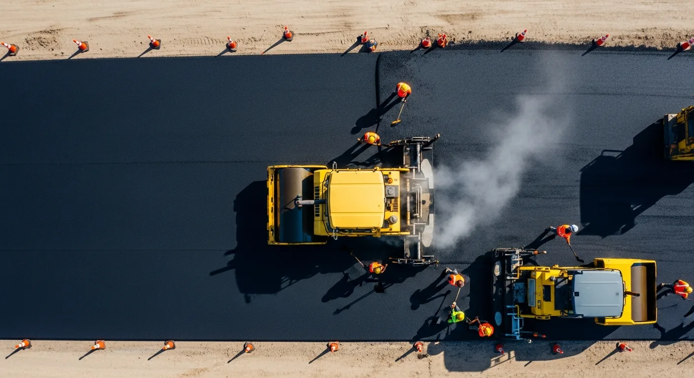
Asphalt Paving and Compaction Guide: Mix Types, Laydown Temperatures, and Quality Testing
Asphalt paving looks straightforward from a distance. A truck dumps material, the paver lays it down, and rollers...
Read More →
Construction Jobsite Wi-Fi & Connectivity Guide: Setting Up Reliable Internet in the Field
A practical guide to getting reliable internet on construction job sites. Learn about cellular hotspots, mesh networks,...
Read More →